 Research Associate Mike Caggiano wrote a blog post for the Fire Adapted Communities Learning Network to share his findings on Collaborative Spatial Fire Management: Getting Ahead of Fire Using Potential Operational Delineations.
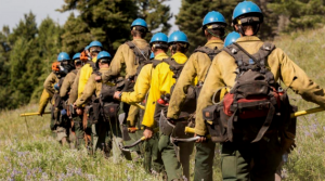
“At the end of a windy summer day, an engine captain receives a smoke report from the dispatch center, readies his crew, and heads up the mountain in search of the fire. The crew rounds a bend and finds the flames. The fire is approximately 1-acre and located on a steep, rocky hillside. The area is covered in dead, standing trees that were killed during the last bark beetle outbreak. In our suppression-dominated past, the captain and his crew would have left their engine and trekked a thousand feet up the hillside, dragging heavy hand tools, chainsaws and supplies with them. Once there, they would begin cutting trees, digging line, spraying water, and trying to keep the fire as small as possible. Without having completed a detailed cost-benefit analysis or risk assessment, those firefighters would have a singular focus: putting the fire out as quickly as possible.”
Read the rest of Mike’s article HERE
